![]()
AURORA GALLERY 4
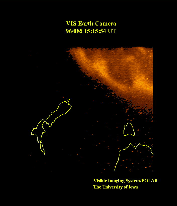
A close-up view of part of the southern auroral oval is seen in the upper right quadrant of this image. The coastal outlines of the island of Tasmania and the southeast coast of the continent of Australia, as well as the islands of New Zealand, have been superposed in yellow on the image. The Earth Camera on the Visible Imaging System took this image at 15:15 UT on March 25, 1996. At the time, the altitude of the spacecraft was 8,800 km as it approached perigee and the geographic latitude and longitude of its position was -43.9° and 158.6°, respectively.